
I left El Paso on February 1st fully prepared to begin the “Borderwalk” segment of my journey.
A few days before reaching El Paso, I planned on walking north to Las Cruces and following Interstate 10 west. “Weird things happen close to the border,” people warned me. The alternative (and my original plan) was to walk New Mexico 9, which runs right along the border for 100 miles or so. In a few spots, it come within a mile of the border wall.
Walking closer to I-10 seemed like the prudent thing to do. It was further from the border and wasn’t as desolate. It offered twice the towns and services along the way. But as I planned out the I-10 walk, I kept getting a strange feeling about it in my gut. Something wasn’t right. I’ve learned on my walks that I always have to trust my gut, even if it’s telling me to select the more illogical option.
“Highway 9 it is, PJ,” I hollered as we pulled out of the La Quinta parking lot.
Before hitting Highway 9 though, I had nearly 30 miles of El Paso and surrounding suburbs to walk through.
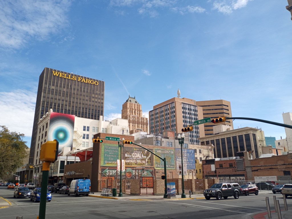
The stroll through El Paso was thoroughly enjoyable. After days and days of desert scenery, the colorful cityscape of El Paso was a welcome change. PJ and I took a detour from the hotel and walked under the bridge that crosses into Mexico. We could see the “Bienvenido a Mexico” sign from the sidewalk. PJ was adamant about going to Juarez but I had to put my foot down and say no. Plus, he doesn’t even have a passport!
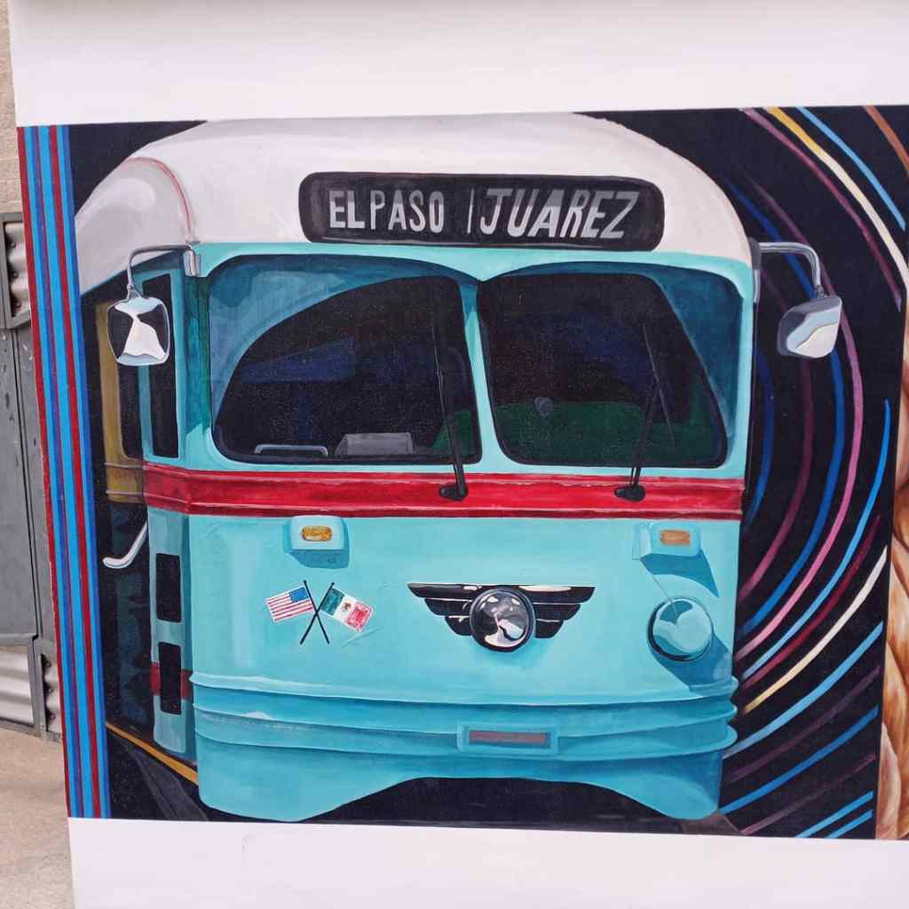
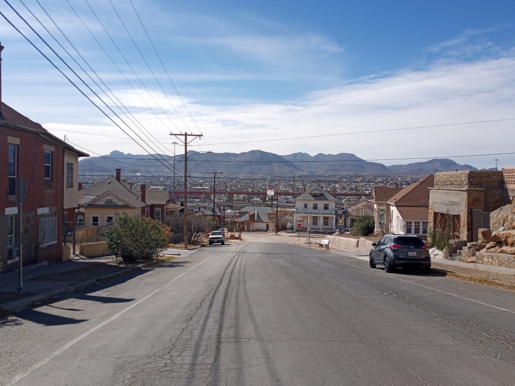
After trekking through downtown and enjoying the big buildings, San Jacinto Square, and a variety of murals, I pushed PJ up a large hill that led to Sunset Heights Historic District. Beautiful homes dating back to the 1920’s were decorated with a Southwestern and Hispanic flair. The sprawling metropolis of Juarez was visible across the sandy Rio Grande.
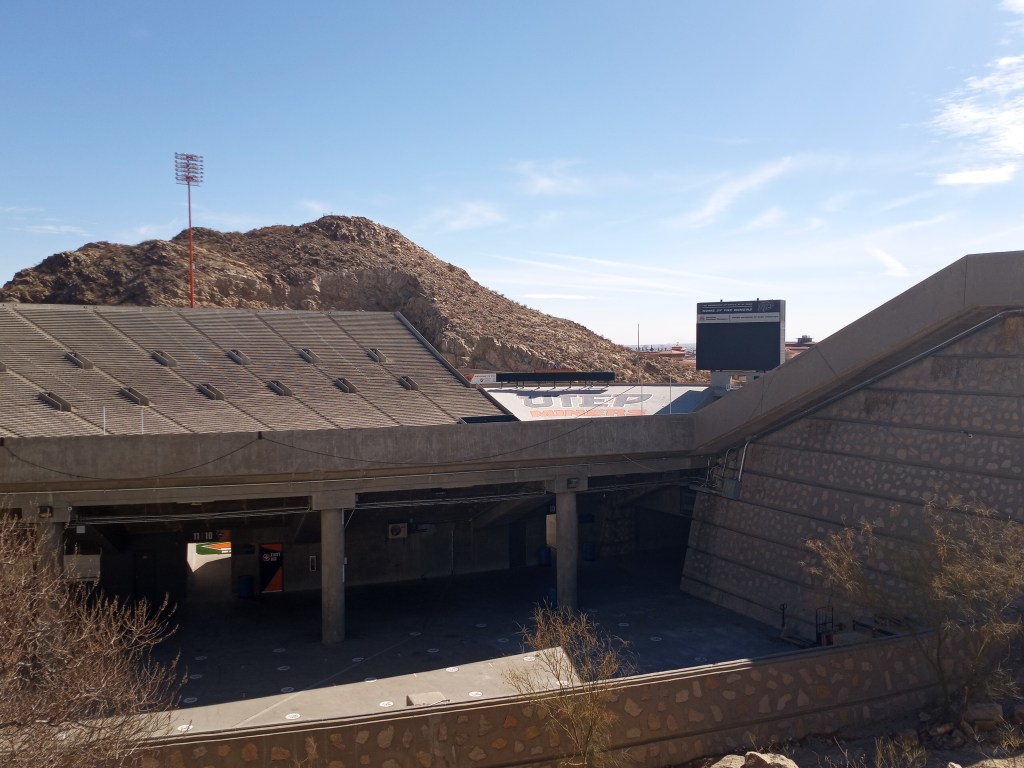
Our tour of El Paso continued with a walk through UTEP’s campus and past the Sun Bowl, which is the university’s football field. The stadium is literally carved out of a mountain!
After a few more errands (bike shop, post office, and Walmart) we were through Central El Paso and walked suburbs until dark. I have walked a lot of big cities during my three treks across the country. El Paso was, hands down, the most walkable. Other than a 50 foot stretch across some railroad tracks, PJ and I had smooth sidewalks, bike paths, wheelchair ramps, and walking men at every corner for the entirety of our 20 mile walk out of the city. Wow!
We reached Santa Teresa, New Mexico after dark and found a decent spot off the highway in the desert to camp for the night. I knew I needed to get comfortable sleeping among the mesquite trees, yucca, and cacti…There is going to be plenty of that moving forward!
After a few miles the following morning, we hit NM 9, which we would follow for the next 147 miles, nearly to the Arizona State Line.
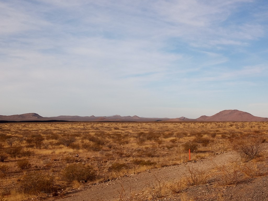
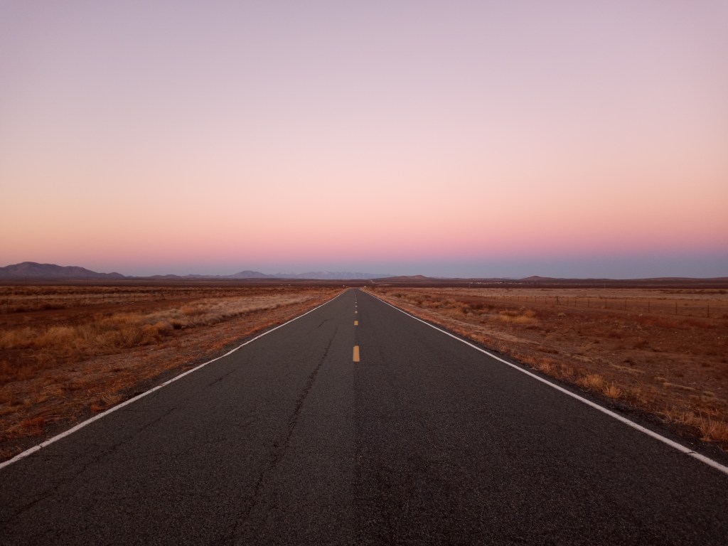
The first day on Highway 9 was strange. After a few miles, the road turned south and I caught my first glimpse of the border wall, which stretched far off into the distance. I can only describe seeing the wall for the first time as surreal.
Given my proximity to the border, it’s no surprise every other vehicle that roared by was a white and green Border Patrol SUV. They weren’t just on the highway. I spotted a few agents driving through the desert seemingly randomly. A few were parked on top of bluffs watching the valley floor. Occasionally one would drive by very slowly on the narrow dirt road between the highway and the barbed wire fence that lined the desert. Although I felt like I was being watched, it gave me a slight sense of comfort knowing the agents were around. At press time, I have yet to get stopped by the “BP,” as I call them.

I spent my first night off Highway 9 camping on some BLM Land within a mile of the wall. I enjoyed a beautiful view of the valley from the top of a small hill where I set up camp. Other than seeing the lights from a few BP’s driving down the dirt road right next to the wall, I was all alone.
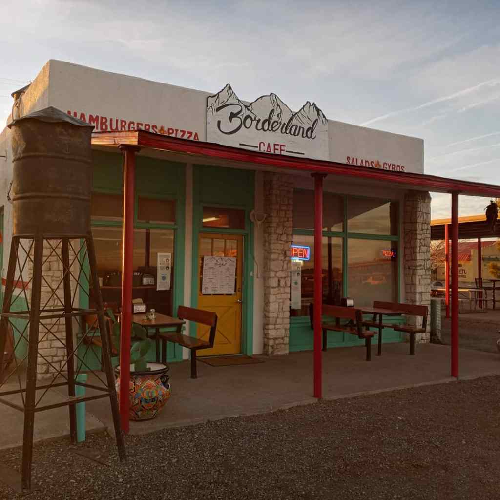
I had a rare deadline when I woke up at 5 AM on February 3rd. The previous day, a man named Conrad (who is from Louisville, CO) stopped and visited with me midway through my walk. He gave me two Mountain Dews and wished me luck on my journey. A few hours later, I received a text from Lawrence, the owner of the Bordlerland Cafe in Columbus. Lawrence told me Conrad pre-purchased a meal for me at the cafe! Lawrence also offered me a spot to camp on the property once I arrived. My goal for the day was to make it there before the restaurant closed at 7 PM.
With beautiful weather and light traffic, PJ and I cruised to Columbus, walking 33 miles in just under 11 hours. We hit the Borderland Cafe with time to spare and enjoyed a delicious, leisurely dinner on the cafe patio (indoor dining in New Mexico is still banned due to COVID). I ate a massive Poncho Burger, complete with Hatch green chilis, enchilada fries, and a salad. Lawrence visited with me for a bit as I enjoyed the tasty meal and beautiful evening. I set up camp next to the restaurant’s patio. Thank you for the gesture of kindness, Conrad, and for your hospitality, Lawrence!
I got a “late” start the following morning and didn’t start walking until 8. The wind picked up by 10 and I was left pushing PJ into 20-30 mph winds. It was a challenging, often maddening day. The highway had no shoulder to speak of. I would normally drown out the noise from the wind by wearing ear plugs, but since I didn’t have a shoulder and was literally taking up a third of the eastbound lane, I needed to listen for cars approaching from behind me. If someone happened to be passing another car at my back, I was right in their way. Every time I heard a car coming up from behind me, I would quickly glance over my shoulder to ensure it wasn’t one vehicle passing another.
Despite the noise from the wind and the physical challenges of the day, PJ and I managed to cover a difficult 30 miles before dark. A mile before we reached our camping spot in the desert, a photographer named Felix stopped and visited with us.
“You look like a man on a mission,” Felix said as he pulled up along side me. “Can I take your picture?” Felix snapped a few semi-candid shots of PJ and I as we pushed through the stiff New Mexcio wind. He pulled over 100 yards later and we visited for a few minutes. It had been a quiet few days socially so I was grateful for the chat. Thank you for the company, and the photos, Felix!
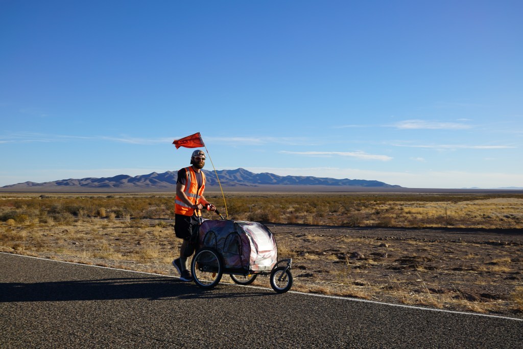
Photo credit – Felix Mena
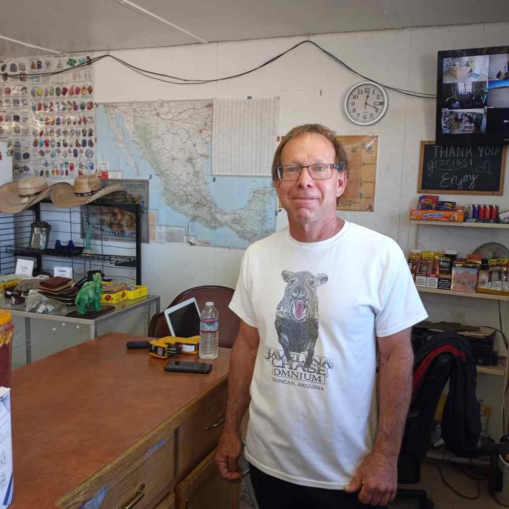
The next morning, I covered the final 14 miles to Hachita by 10 AM. I stopped off at the Hachita Food Mart for a morning break. The Continental Divide Trail (which runs along the divide from Mexico to Canada) is a popular mountain biking and hiking route in the spring and fall. The store in Hachita is a little oasis in the desert for thru-hikers and bikers.
I sat inside and visited with Jeff, the owner, for a few hours while I drank a cup of coffee and a half gallon of milk…then proceeded to eat a sandwich, honey bun, and a bag of goldfish.
Jeff is certainly a kindred spirit. He is an avid cyclist and outdoor enthusiast and has biked the entirety of the Continental Divide Trail from Mexico to Canada, which is well over 3,000 miles. It was nice to be on the asking end of questions for a change, like “How long did it take you,” and “How many miles a day did you ride?” Additionally, he is a hell of a nice guy and was a great host for the two hours I spent at his store. Great meeting you Jeff, and thank you for your hospitality!
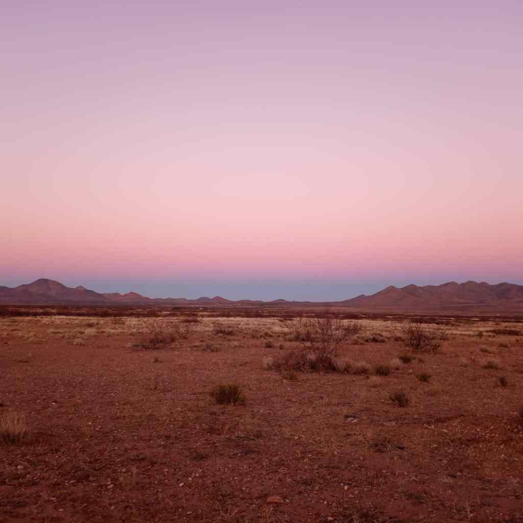
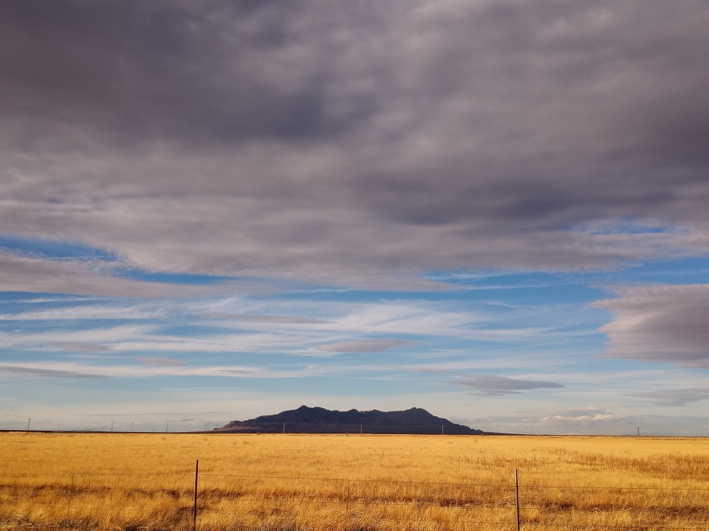
I left the store at noon and continued my walk west. After a modest eight mile climb to the Contintental Divide Trailhead, it was all downhill for the rest of the day. I could make out the faint outline of the Chiricahua Mountains (which I would walk next to the following day) in the distance. I ended my walk cowboy camping in a massive dirt lot off the highway. I enjoyed another crystal clear night, starry night in the New Mexico desert. The Milky Way kept me company as I drifted off to sleep.
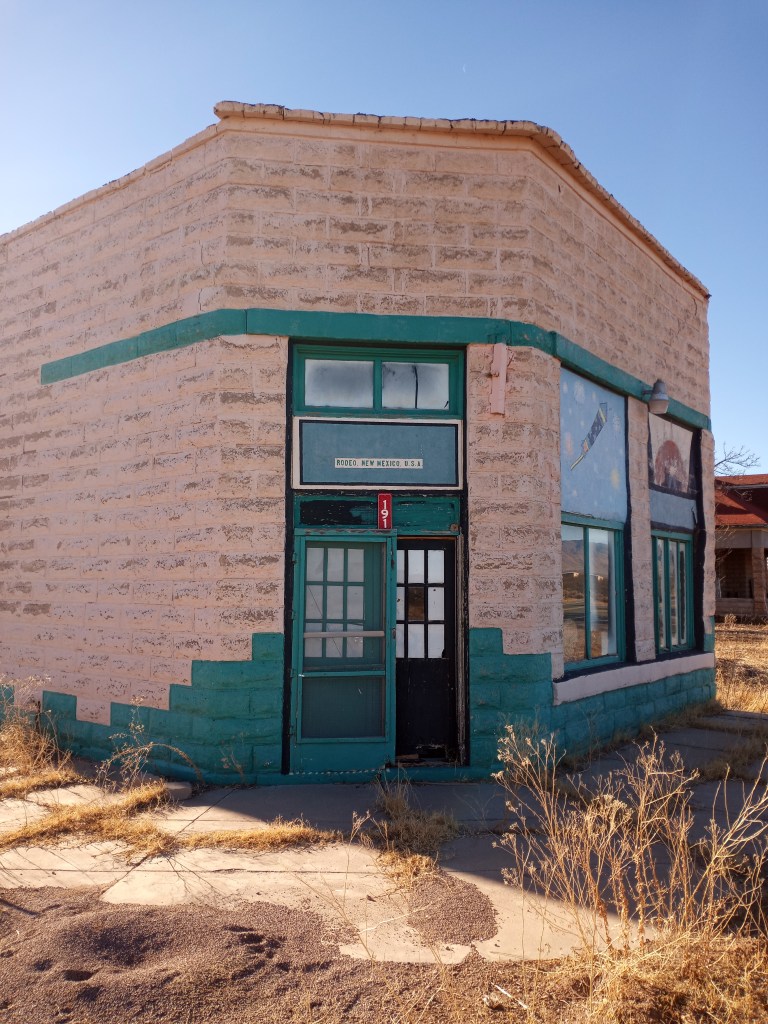
I began my last full day in New Mexico on February 6th. The Land of Enchantment provided some memorable scenery during my 35 mile walk to Rodeo. The Chiricahua Mountains to my west were visible all day. I also formally crossed the Contintental Divide five miles east of Animas. I hit another walking milestone as well. As soon as PJ and I hit the end of NM 9 and turned left on Highway 80 (which we would follow south to Douglas) we reached 2,000 miles on our current walk. A “rainbow sunset” in the Chiricahua Valley capped off another scenic day in New Mexico.
After camping at a little RV Park in Rodeo, I began packing up and preparing for the 50 mile walk to Douglas. However, the morning didn’t go as planned. After breaking down my tent, I noticed my water jug was leaking. A few inches of water had settled on the “floor” of my stroller.
No big deal. There was a gas station and grocery store in town. I decided to buy a few gallon jugs of water for the upcoming 50 mile stretch, which didn’t have any services. I called the store the previous day and the woman working said they were open from 8-2. When I arrived, a big sign on the front door said “Closed Sundays.” To be fair, I loose track of what day it is all the time.
On to Plan B. I walked back to the RV Park and put several layers of duct tape on the bottom of the jug over the leak. Then, I filled it with a gallon of water and set it down. I waited 30 seconds, picked up the jug, and discovered a pool of water underneath it. After thousands of miles of walking, I actually found something duct tape can’t fix! Then I had a brilliant idea – transport the jug upside down! When I flipped it over with the pour spout facing down it didn’t leak, and water wasn’t coming into contact with the compromised plastic on the bottom.
With my water problem solved, I happily got back on the road and continued to the Arizona State Line!
After a few ceremonial pictures next to the “Welcome to Arizona Sign,” I cruised towards Douglas.

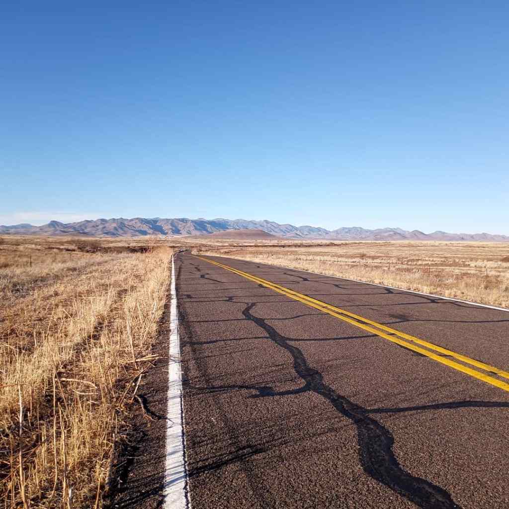
The walk through Southern New Mexico on Highway 9 was desolate. I didn’t think it was possible, but the walk south to Douglas on Highway 80 was even more desolate! I didn’t have any cell service from Rodeo until I was about 10 miles from Douglas. That meant a whole walking day with no internet, social media, calls, or texts. Just a man and his beloved buggy in the Arizona desert. Truth be told, it was one of my favorite days of the walk. Disconnecting from the world and simply walking with zero distractions was humbling, cathartic, and centering. The incredible scenery helped, too.
I found another great camping spot near mile marker 390, about 22 miles from Douglas, and called it a night shortly before sunset. I was asleep by 6:30.
I woke up at 3:30 AM and, to my surprise, was wide awake. I decided to get an early jump on the day. I was pushing PJ through the dark by 4. The final 22 miles into Douglas flew by. We hit town by 11 and checked into a Motel 6 room shortly after that. PJ and I had walked 230 miles in eight days since we left El Paso. It was a physically and mentally challenging stretch. I earned every bite of the delicious burritos I gorged on from the gas station next door!
Favorite Three Pictures
Walk Recap
Days – 91
Miles – 2,056
Peanut Butter Jars Consumed – 74
Roadside Change Found – $5.51
Miles Per Shower in New Mexico – 96.66. It took 11 days to walk 290 miles across New Mexico, and I squeezed in three showers!
From Douglas, AZ, I will have my work cut out for me! After walking to Sierra Vista on Hwy 92, I’ll head north on Hwy 90, west on Hwy 82, north on Hwy 83, then follow a dirt road through Madera Recreation Area towards the tiny town of Continental. From there, I’ll head due north to Tucson and northwest to Phoenix on Highway 79. The desert will continue to provide beautiful scenery and plenty of challenges as I enter my final month of walking. I can’t wait to see what awaits on the road ahead.
Walk on!
-Ben

I so enjoy your photos and commentary. You are an inspiration. I’m thankful I found your adventure on Facebook and can also see this expanded version on your blog. Amazing…just amazing.
LikeLike
Wonderful just wonderful! Your story and photos are inspirational! Nice Ben! And think of the places you could go if PJ got his passport. Walk in dear friend! I can feel it in my bones that someone amazing is coming into your life soooon! Haha!!! Oh gosh 😁. 🤦♀️Don’t pay any attention.
LikeLike
I think she is here!
LikeLike
Great photos and narration about your ventures through Texas and New Mexico, Ben. The warmth and sunshine captured through the pictures sure look inviting since it’s -25 here in the Twin Cities!!
Happy Trails!
Liz
LikeLike
Enjoyed our walk even thou there was the water jug issue. Pictures are beautiful. So glad for the friends along the way. Be safe. Walk On
LikeLike
Hey Bonnie! Thank you – I can sure understand why you call AZ home in the winter! So beautiful 😃 Hope all is well!
Ben
LikeLike