
The nine day, 231 mile jaunt from Tempe, Arizona to Blythe, California featured a variety of challenges and new experiences! I wasn’t going to coast through the final 200 miles of Arizona.
I left my friend Shane’s house in Tempe on February 20th. California was still a ways away, but I could hear her calling.
I spent the first few hours of the day wandering through Arizona State University’s surprisingly lush campus and lively downtown Tempe. It was another sunny, picture perfect winter day.
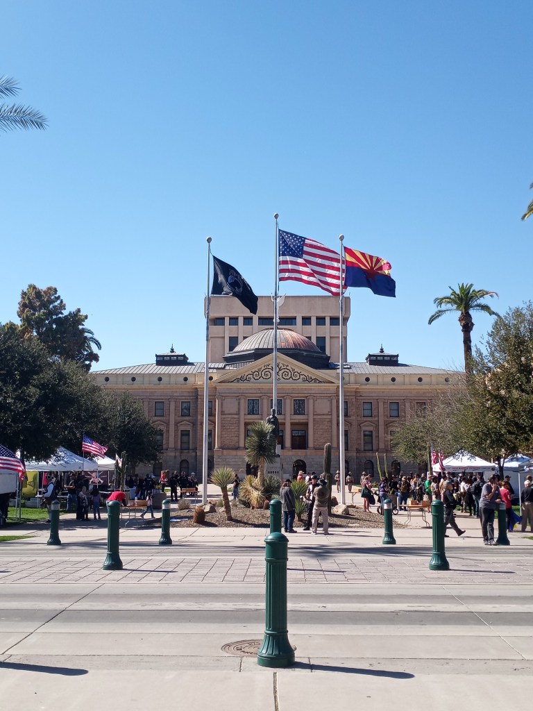
From Tempe, I headed west towards downtown Phoenix and the Arizona Capitol building, which was the third Capitol I’ve visited my walk (the other two were in Tallahassee and Baton Rouge). As I approached the building, I noticed a massive crowd was gathered. There happened to be a Pro-2nd Amendment rally in progress. Attendees wore assault rifles and hand guns like they were fashion accessories. The whole scene made me uncomfortable, primarily because I’ve haven’t been around many guns. I snapped a few quick photos of the Capitol as rally attendees curiously watched PJ and I.
After leaving the crowd, I walked to Grand Avenue, which eventually turned into Highway 60. It was a straight shot northwest out of downtown Phoenix.
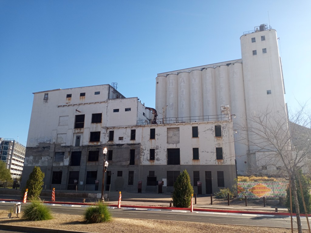
Although it was the most direct route out of the center of the metro area, it was far from the most scenic. The six lane, divided road was heavily traveled and passed through industrial areas for the next 15 miles. There were interchanges I needed to detour around every few miles, which complicated matters. I got turned around on sidewalks that hit dead ends several times.
I ended up walking 30 miles and ended my day well after dark. I camped off a bike path near a dry wash in Sun City. After another 15 miles in the morning, I finally cleared Phoenix’s urban sprawl. My walk through the Phoenix metro area totaled 62 miles!
Even after leaving the city, there was still a massive amount of traffic on Highway 60 heading towards Wickenburg. The road was so loud I could barely hear the music from my speaker when it was on full blast! I wore ear plugs for the majority of the day to drown out the noise. I reached the post office Morristown at 5 PM.
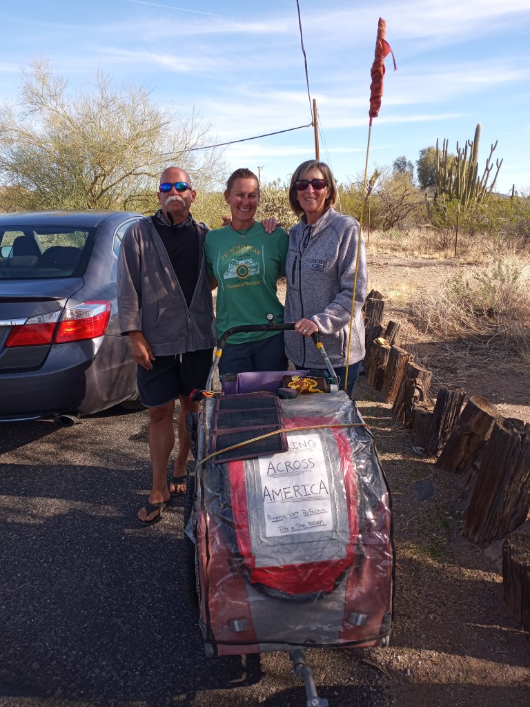
A few minutes later, I had some company! Jan, a good friend of mine from Fort Bridger, Wyoming, made the drive to Arizona to spend some time camping and hiking with Allison, who is a full time Arizona RV’er. The three of us had been planning a little “camping trip within a camping trip” for weeks. Due to a few snowstorms in Wyoming, Jan’s arrival was delayed.
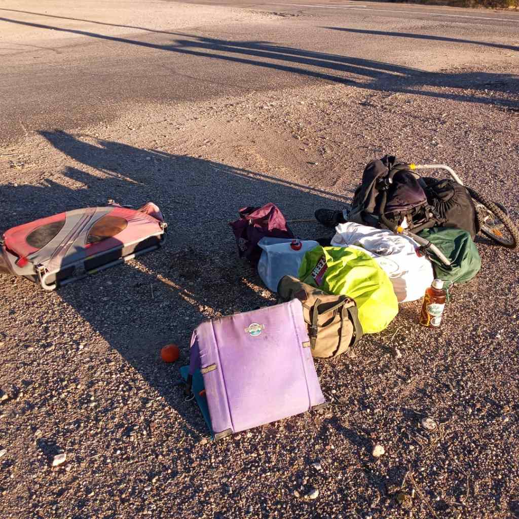
I broke PJ down and loaded him up into the trunk of Jan’s Honda Accord.
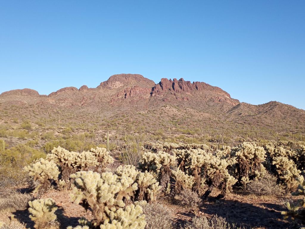
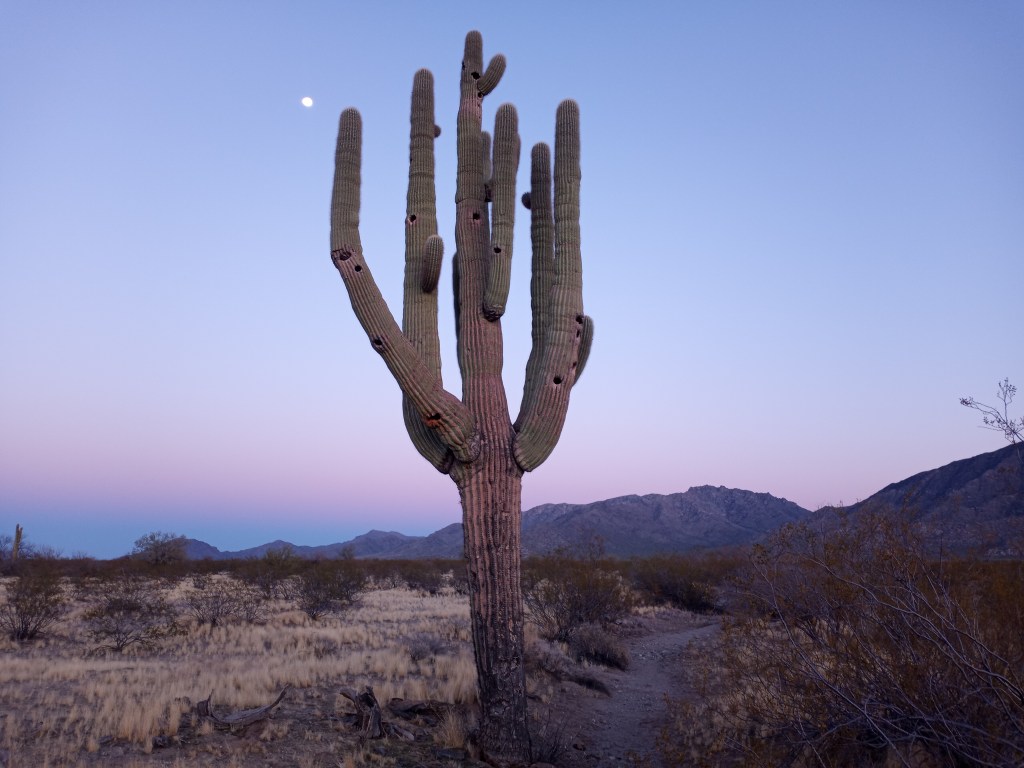
We drove through Wickenburg and camped at a primitive campground at the base of beautiful Vulture Peak. Saguaro and chollo cacti lined the desert floor. I spent two nights and took a rest day with Jan and Allison. They are both avid hikers and simplistic travelers. We had a blast sharing stories and exploring the quaint Western town of Wickenburg. Thank you for the amazing visit and company, ladies!
From the Morristown Post Office, I was five challenging days away from the California/Arizona border! I covered the 10 miles into Wickenburg and picked up a few last minute groceries at a Safeway in town. After Wickenburg, I wouldn’t walk through a town with more than 1,000 people for 170 miles.
It was refreshing to get back into the unpopulated desert after leaving Wickenburg. Traffic levels quickly declined and I was able to loose myself in the peaceful landscape. I camped at the crest of a hill 10 miles west of Wickenburg after a 24 mile walk from the post office in Morristown.
In the morning, I made my way towards Aguila. I found myself walking through a long, flat expanse of desert for the entire day. There were mountains on both sides of the highway, but 60 cut right through the valley and was flat as a pancake.
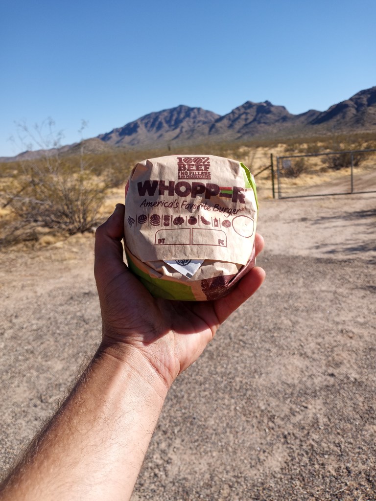
After passing through Aguila, a Honda Civic pulled over on the shoulder. The driver must have been double masking it because I couldn’t understand a word he said. I parked PJ and scampered across the highway.
“You want a Whopper?” That was the easiest question I’ve been asked on my walk to answer. The man handed over the burger and said he would give me a ride if he didn’t have his dog with him. “I’m good walking,” I told him. He drove off and I scarfed down the burger on the shoulder. I didn’t catch the guy’s name, so he will forever be known as the “Arizona Whopper Man.”
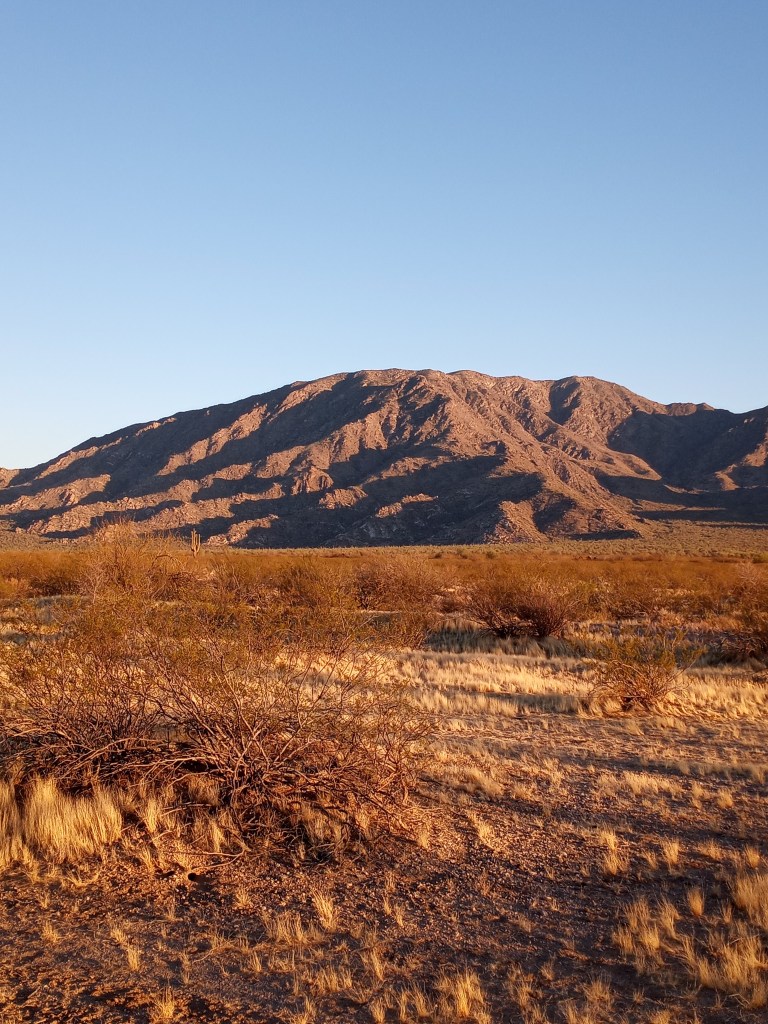
I ended the day camping on some BLM land at the foot of beautiful Harquahala Mountain. There is a ton of BLM land in Western Arizona, making it pretty easy to find camping spots where I can rest easy and avoid stealth camping!
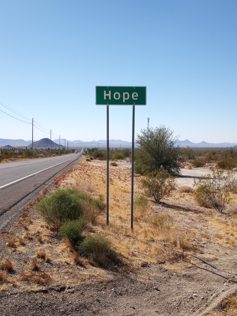
I finished off the final 20 miles of my walk down U.S. 60 the next day. Once I hit Hope, I turned right on Highway 72 and began what I call the “Parker Detour.” Highway 60 runs into I-10 near Quartzsite. Since pedestrians can’t legally walk ANY interstate in Arizona (and there are no frontage roads along the freeway for the last 30 miles into California) my only alternative was to head northwest towards Parker, cross the Colorado River south of town, then head south to Blythe. The detour would add about 50 miles of walking.
I walked six miles on Highway 72 before finding my rocky BLM accommodations for the night. Based off my Google satellite research, I knew 72 lacked a shoulder. I didn’t expect so much traffic though. It was a tricky six mile stretch, and I had another 30 miles to walk the following day. After I set up camp, I put the difficult stretch I’d face in the morning out of mind and brought my attention back to the present.
From my campground, I could faintly make out the lights from Hope, flickering on the valley floor.
“A glimmer of Hope,” I said out loud. Those four words hit me unexpectedly.
I flashed back to my early days in recovery in the spring of 2017. I had made some terrible mistakes while I was an active alcoholic. I was lost. I didn’t recognize the person I saw in the mirror. I felt hopeless. But after I committed to a sober lifestyle and started working a program, I found that faint glimmer of hope I desperately needed. I could barely see it through the fog that engulfed my life. But I could feel it. I let that light guide me and with a lot of work and some time, it got brighter…and brighter…and brighter.
A little hope can go a long way. Reach for it. Chase it. And no matter what, don’t let it go. I rested easy in the rocky desert. I was grateful I held on to and chased that initial glimmer of hope. And I have so much gratitude for where my journey in sobriety has taken me.
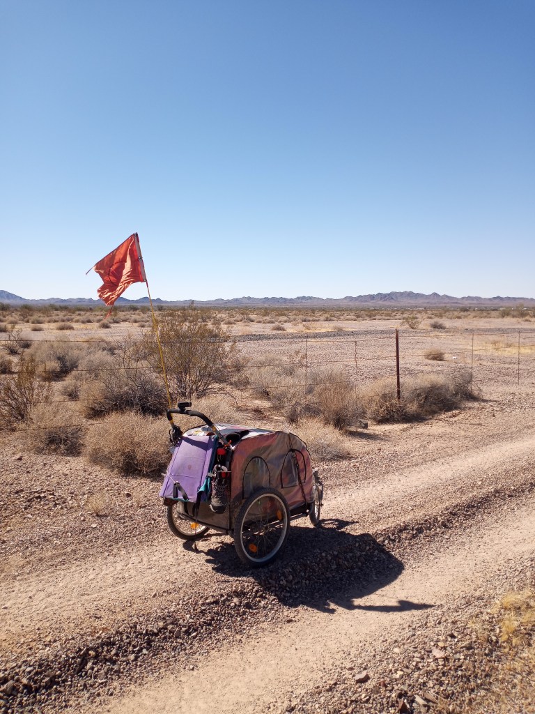
I started walking at 7 the next morning. My fears about Highway 72 were confirmed. I held out hope the high traffic level the previous night was an anomoly. But a steady stream of cars greeted me. I dealt with the traffic for a few miles until I noticed a small dirt road 50 yards off the highway. It ran underneath some power lines next to a barbed wire fence. I wasn’t sure how long I could walk the path for, or how walkable it would actually be given PJ’s tendency to struggle with rocks and sand.
Overall, the path was pretty walkable. The sand got thick in a few spots and the path would dip into a wash a few times every mile. When that would happen, I’d get a running start and simply plow through the sand. It was a workout, but was a much better option than fighting a steady stream of traffic without a shoulder.
We followed the dirt path for 18 miles into Blouse.
From Blouse, I discovered a primitive road which ran parallel to Highway 72 through the rocky desert. There wasn’t a single car on the quiet road. There wasn’t much sand to contend with on La Pos Road, but there were several rocky sections that took some serious effort to get through. We hit the highway again just before dark. Although I had walked a modest 28 miles, I was exhausted from expending so much extra energy navigating through sand and rocks throughout the day. I camped on a sandy bluff overlooking a little wash.
I began my final 25 miles in Arizona the following morning. I knocked out the last five miles on Highway 72 before the sun came up, then turned right on Highway 95 and headed closer to Parker. Traffic on 95 was even heavier. The shoulder was just as bad. I walked another much sandier and frustrating power line road for a few miles, then returned to the bumpy, gravel shoulder. At one point I pushed PJ straight through the desert, avoiding small shrubs and mesquite trees, because I was fed up with the highway and the power line road. Fortunately, I only had the Arizona portion of 95 to deal with for eight miles.
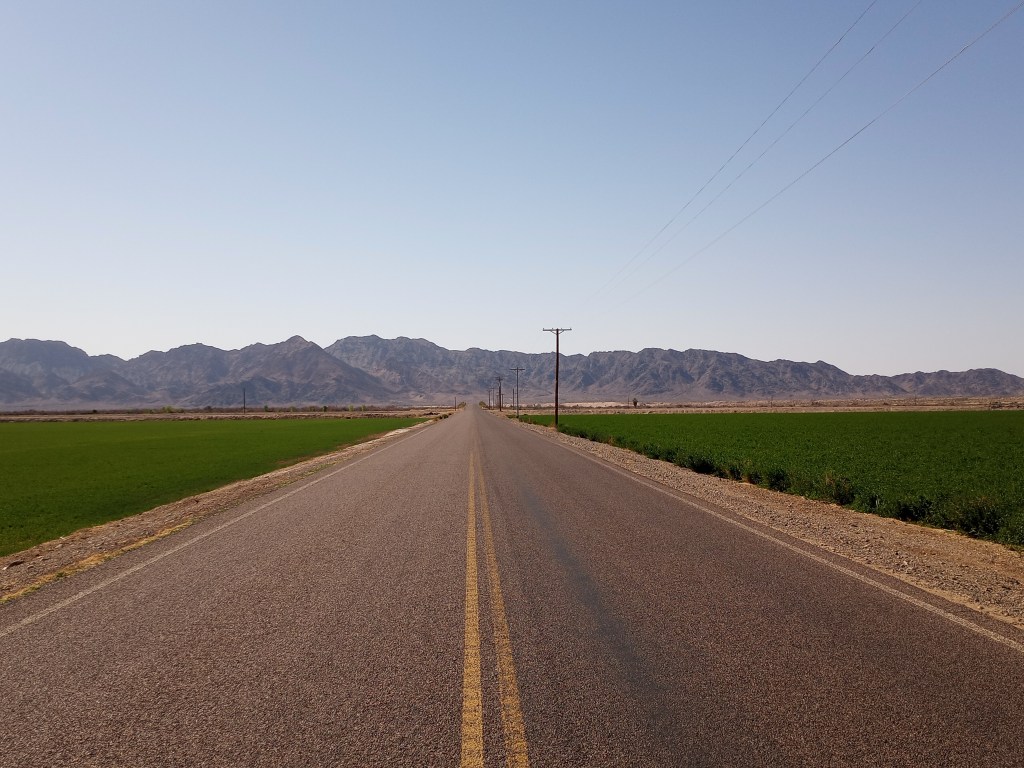
Four miles south of Parker, I turned left on AZ 10 and walked 12 miles through a quiet, agricultural valley on the Colorado River Indian Reservation. Healthy hay and alfalfa fields, palm trees, an occasional canal, and distant mountains gave me plenty to look at. The peaceful stretch was a polar opposite to the way the day started! Every passing car gave me a friendly smile and a big wave.
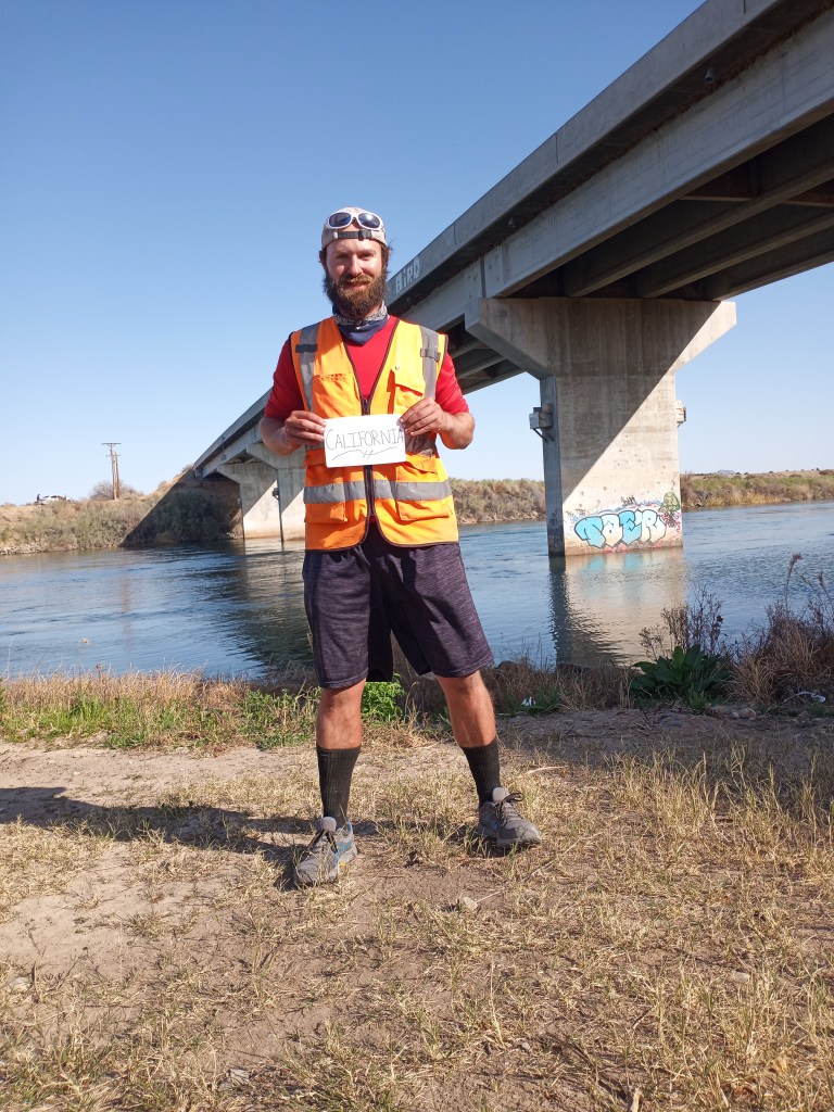
I hit Agnes Wilson Road and crossed the Colorado River around 3 PM, entering the final state of my walk – California! There wasn’t a welcome sign at the state line, so I improvised.
Three miles later, I hit the California side of U.S. 95. To my pleasant surprise, there was less traffic. Still no shoulder, but less traffic! I walked another few miles and called it a day. I camped on a large bluff overlooking the Colorado River.
PJ and I left our bluff at 4 AM in the morning. I knew the first 20 miles of the walk were going to be tricky without a shoulder. I guessed traffic levels would be low at that ridiculous hour on a Sunday morning. I guessed right! It was a quiet first 10 miles under a bright, nearly full moon. Only 17 cars passed between 4 and 7 AM.
The wind picked up after sunrise, but to my pleasant surprise, the 30 mph gusts were at my back! Aided by the wind (and a long overdue paved shoulder for the last 12 miles), it was an easy breezy walk into Blythe.
Highway 95 provided some great views of the Colorado River, sandstone cliffs, dry washes, and passed by the “Blythe Intaglios” along the way. The Intaglios are massive, ancient drawings in the desert. One of the drawings was of a horse-like animal. The second resembled an alien. They were mysterious, thought provoking, and very difficult to photograph!

The last few miles into Blythe went well, other than a visit from the California State Patrol. A driver called them saying they “feared for my safety.” When the patrolmen pulled up, I was walking with traffic to avoid a blind curve.
“You know you should be walking facing traffic, right?” One of the officers told me. I explained (maybe a little too indignantly in retrospect) that I walk where the cars can see me. The officer nodded in understanding.
“You got a baby in there?” The other patrolman asked. We visited for a few minutes and they were kind and cordial after our initial introduction.
I triumphantly reached Blythe at 3 PM, capping off a challenging and interesting nine day walk. I checked into a Motel 6 and showered right away, washing off hundreds of miles of dust, sand, and dirt from my grimy body! It was heavenly.
Favorite Three Pictures
Trip Stats
Days – 111
Miles – 2,555
Jars of Peanut Butter – 97
Roadside Change Count – $6.13
Miles Per Shower in Arizona – 102
From Blythe, I am a mere 250 miles from San Diego, which is hard to believe! Despite being on the final leg of my journey, I will approach every remaining day as if it will be the toughest of my walk. And you better believe I’m going to enjoy every remaining minute! Walk on!
-Ben

We’re just so thrilled for you Ben!!! It was a wonderful insightful time that we spent with you. Thank you so much for your gentle and happy natured company. We will always remember it and be better because of it. Your tenacity and perseverance have taught me a thing or two for sure! We are overjoyed with your near completion. But not as much as you we bet!! Thank you for this beautiful post as of late. It’s simply the best part of my day!
LikeLike
Thanks Ben for the update. My good friends and neighbors, Clayton and Dorothy Pierce, were “snow birds” in Wickenburg for many years. My parents and I never visited them while they were there, but seeing your photos makes me want to take a journey there next winter!
I especially enjoyed the photo of the Harquahala Mountains at sunset
Happy Trails!
Liz
LikeLike
Hey Liz! Wickenburg is a great little town – probably my favorite in Arizona! The BLM land nearby was incredible, too! Happy Spring!
Ben
LikeLike
Enjoyed the last few days in AZ and loved the pictures. I suppose you can see why Kris & I enjoy AZ. Be safe Ben and Walk On :0)
LikeLike